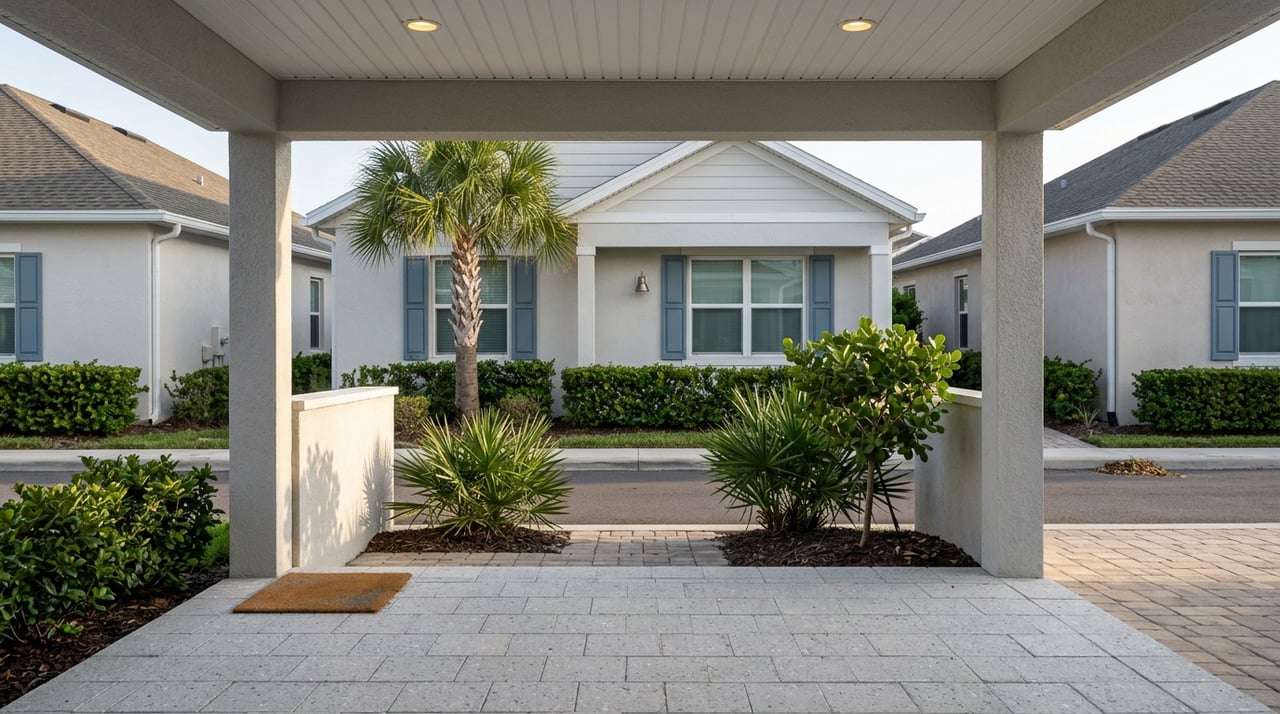
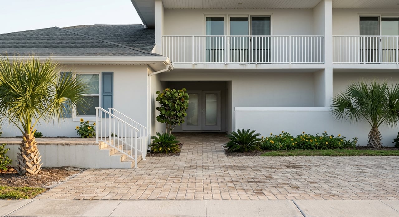
Melbourne Waterfront Homes: Boat Access and Bridges
January 1, 2026
January 1, 2026
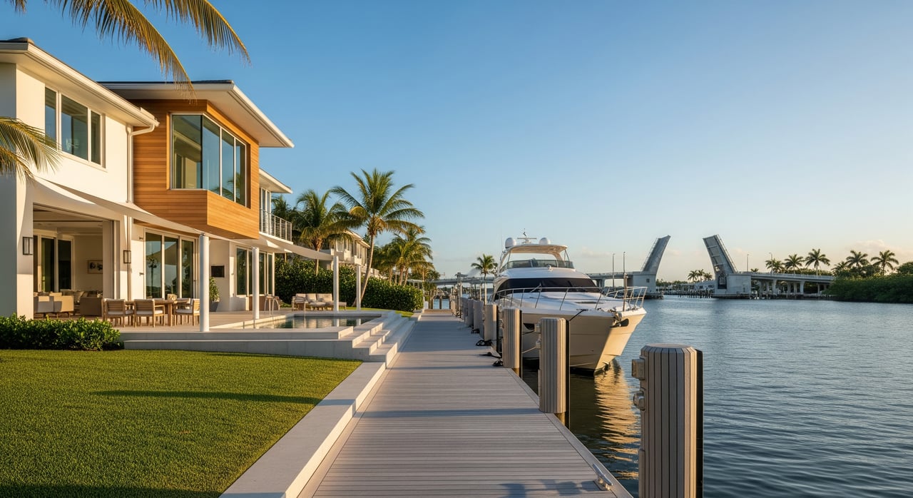
Dreaming of stepping from your backyard into your boat and cruising the Indian River Lagoon? In Melbourne and across Brevard County, that dream can be real, but your boat’s access depends on more than a pretty view. Water depth, bridge clearances, and local rules can shape how easily you reach open water. In this guide, you’ll learn how to evaluate a waterfront home’s true boating potential, from canals and tides to permits and insurance. Let’s dive in.
The Indian River Lagoon runs along Melbourne’s mainland and barrier island and forms part of the Intracoastal Waterway. This protected route connects private docks and marinas to the wider Florida coast. You can review channels, aids to navigation, and bridge information on the latest NOAA nautical charts.
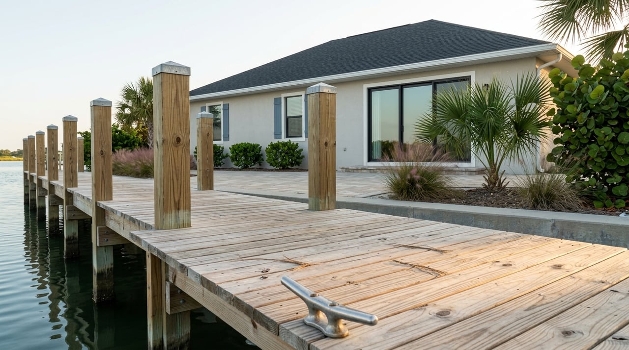
If you plan to cruise regularly, homes with direct lagoon or ICW frontage usually offer the most straightforward access. You still need to confirm depth, tides, and the nearest channel, which are all charted or available through local notices.
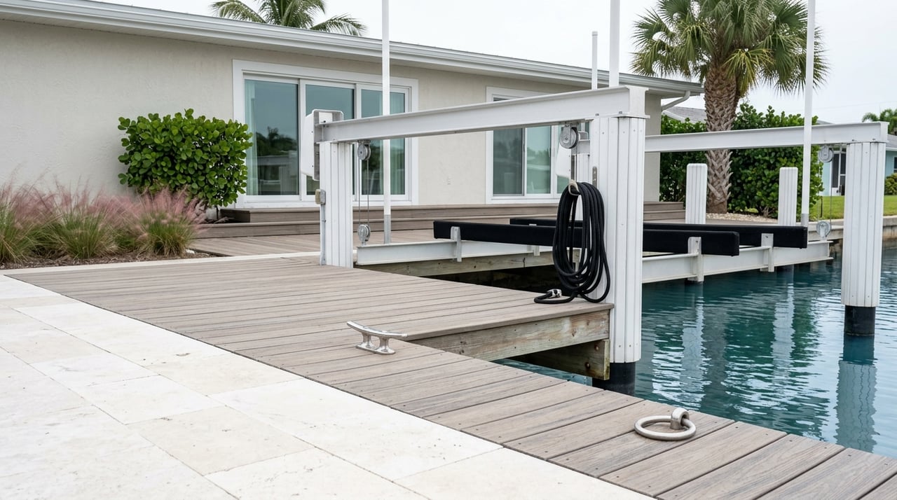
Some Melbourne-area homes sit on the Banana River or along man-made canals that cut to the lagoon. These canals can be shallow in spots and may limit vessel size. If your boat has a deeper draft or a tall mast, measure the route carefully and confirm whether your canal has a maintenance or dredging plan.
Oceanfront homes on the barrier island offer a different lifestyle. You get direct Atlantic views and beach access, but offshore boating typically happens from the lagoon side or via marinas. Trailering across the island to a ramp can be simple, though bridge traffic and height limits for vehicles and trailers may affect logistics.
The number that matters most is the water depth at mean low water (MLW) where you dock or along your canal. Depth can shift with storms and seasonal shoaling, so verify the lowest likely water level using NOAA Tides & Currents. Ask for date-stamped measurements or a recent survey, and compare that with your vessel’s draft plus a safety margin.
Charted channels, markers, and bridge clearances help you understand your likely route. Always consult the most recent NOAA nautical charts for the Indian River Lagoon and nearby waters. Look for maintained channels, notes about shoaling, and the posted vertical clearance for any bridges you must pass.
Even if you keep a boat at home, nearby ramps and marinas give you options for fuel, service, or trailering on rough days. Use the Florida Fish and Wildlife Commission’s statewide map to find sites near Melbourne and the beaches through the FWC boating facilities and ramps. Local marinas are also a great source of real-time knowledge about shoaling, safe routes, and transient slip availability.
Bridges along the lagoon and the ICW come in two basic types. Fixed-span bridges have a set vertical clearance, so boats taller than that cannot pass. Movable bridges, such as bascule or lift bridges, can open on schedules or on demand under federal rules. You can review the governing regulations for drawbridge operations in the Code of Federal Regulations, 33 CFR Part 117, and you can find operational details and contacts through the U.S. Coast Guard Navigation Center’s bridge information.
To avoid surprises, plan your route with three checks:
If you own a sailboat or tall center console, clearance can become a daily planning item. Know the lowest fixed clearance on your route and whether any movable bridges hold during rush-hour traffic. If delays are frequent, consider a different mooring plan, a shorter route to a marina, or a property with unimpeded ICW access.
Work in or over navigable waters usually requires permits. In Florida, the Florida Department of Environmental Protection oversees Environmental Resource Permitting for many waterfront projects. Review current guidance at FDEP’s ERP program. Activities that affect navigable waters or wetlands can also require federal authorization from the U.S. Army Corps of Engineers. See the Jacksonville District’s USACE Regulatory Division.
On top of state and federal rules, Brevard County and city departments handle building and zoning approvals. Always verify local requirements through Brevard County’s official site and confirm whether your property falls under municipal jurisdiction.
The Indian River Lagoon is a sensitive estuary. Seagrass beds, protected species, and water quality measures can affect dock placement, lighting, and dredging. You may be asked to avoid certain areas or add mitigation. Plan extra time for reviews and consider an environmental consultant for complex projects.
Many canal-front and condo communities have rules that govern slip assignments, vessel sizes, guest usage, and maintenance obligations. Ask for the HOA documents early so you can confirm that your planned boat fits the rules.
Waterfront homes often sit in FEMA-designated flood zones. Lenders can require flood insurance based on your zone and elevation certificate. You can check a property’s designation at the FEMA Flood Map Service Center. Insurance pricing can vary with elevation, seawall condition, and proximity to open water.
Homeowners insurance typically does not cover your boat. You will need separate boat insurance, and marinas often require proof of liability coverage for slip tenants. Ask your insurance provider about dock structures as well, since some policies treat docks or lifts differently from the dwelling.
Salt and brackish water accelerate wear. Budget for periodic dock inspections, deck board replacement, pile wrap or repair, and seawall upkeep. If your canal relies on community dredging, ask about the schedule and the cost-sharing plan.
Before you submit an offer, gather the facts that determine how well the property works for your boat and lifestyle.
You deserve a waterfront home that fits your boating style, not just the view. A local advisor can coordinate dock and seawall records, point you to the right charts and tide stations, and help you weigh bridge clearances against your specific vessel. If you are relocating or buying a second home, you can do much of this remotely with virtual tours, recorded walkthroughs at low tide, and organized document reviews.
As a Space Coast specialist serving Melbourne, Indialantic, Indian Harbour Beach, Satellite Beach, Melbourne Beach, and Cocoa Beach, I combine neighborhood insight with family-focused service. I am bilingual in English and Spanish and work comfortably with remote buyers and busy sellers. When you are ready to explore Melbourne waterfront homes, let’s plan your route from backyard to open water together. Connect with Milly Akins to start a personalized waterfront search or to prepare your home for market.
Stay up to date on the latest real estate trends.
Milly is active in her community, loves spending time with her family and Belgian Malinois, and believes in helping others. She works with both buyers and sellers and is ready to show you what a seamless real estate experience feels like.